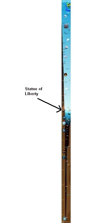
Our Amazing Planet: Top to Bottom infographic
February 17, 2011
Designed by Karl Tate, Our Amazing Planet: Top to Bottom is a cool infographic that looks at the scale of things from the upper atmosphere to the deepest ocean depths. It’s also timely with recent events, showing the depth of the Deepwater Horizon oil rig spill, and drilling depth.
The infographic is HUGE (14,677 pixels tall), and that keeps it accurate to the scale. It’s unreadable when the entire infographic is viewed on the screen, and that adds to the readers grasp of how big this scale really is. Here’s a smaller version.
You may have noticed, on the large version, what appears to be a glaring error in regard to the Grand Canyon. The bottom of the Grand Canyon is obviously not 6,000 feet below sea level. In fact, the bottom of the Grand Canyon is about 1,850 feet above sea level. The north rim of the Grand Canyon rises about 1,200 feet higher than the south rim, with the highest point on the rim being around 9,000 feet above sea level, which, on this infographic, would fall just slightly below the height of the geographic south pole and around 2000 feet above the height of cumulus clouds.
I don’t think Mr. Tate could actually have made such an obvious mistake. He shows the rim of the Grand Canyon at sea level in order to bring a sense of scale to the depth of the bathypelagic zone.
For more cool information about our planet, please visit ouramazingplanet.com

Filed in Uncategorized
Tags: above sea level, abyssopelagic, amazing planet, bathypelagic, breath hold dive record, death zone, deep sea, deepest diving mammal, deepwater horizon, denver elevation, depth of titanic, drilling depth, elevation, epipelagic, geographic south pole, grand canyon, grand canyon depth, hadopelagic, height, highest flying bird, infographic, Karl Tate, knowledge, learning, Lhasa elevation, Mariana Trench depth, mesopelagic, nature, north rim elevation, oil rig, Our amazing planet, planet, Puerto Rico Trench depth, scale drawing, science, scuba diving record, size of things, south pole elevation, Tallest building, top to bottom, trivia

